
Ballacross Well (7) – Arbory
Information
Ballacross Well, Arbory. Ballacross is the name of a farm which took its name from the siting of a cross.
On the estate of Ballabeg, in the parish of Malew, is the foundation of a keeill, the interior of which is 21 feet by 12 feet. The entrance, about 2 feet wide, is in the west gable. The remains are in a field called Magher Undin (Foundation-field), indicating that the foundation only of the church remained when the field was named.¹ Graves have been found close to the structure.
The field adjoining that in which the remains are is called Magher chibber-undin, and derives its name from its containing an ancient well in connection with the church. The water from the “chibber,” or well, was, doubtless, used for baptismal purposes. There is a superstitious notion among the peasantry that the water from this well has curative properties.
Within recent years persons have assembled on the eve of St. John’s Day to test its virtue. A hawthorn tree overshadows the fountain. Every patient took a mouthful of the water, retaining it in his mouth until he had walked thrice round the well. A piece of cloth, part of some garment which he had worn, was then wetted with the water, and hung upon the tree. When the cloth rotted away the cure was supposed to have been effected.
¹ The name of this ancient church is now forgotten, but from the circumstance that persons were wont to assemble at the well on the eve of St. John’s
(text source: First Report of the Archaeological Commissioners on the Pre-historic Monuments & Other Antiquities of the Isle of Man, 1878)
![]()
Urns have been found at Ballacross in Arbory. By the well on this farm it is said that there stood a cross, where all christenings used to be made. Until very recently water was brought from it for every christening at the parish church.
(text source: Surnames & Place-names of Isle of Man, A.W.Moore, 1890)
![]()
Extract from an Excursion to the Sloc, 1899…
A last stoppage was made at Ballacross, where Canon Kewley pointed out the site of the Pre-historic burial ground and the Cist in which was found the curiously shapen Urn described at a former meeting. The Urn itself was also shown. Near by was the Holy Well, water from which was until very recently always used for baptism in the parish church. The cross from which the farm is supposed to take its name stood upon a mound above, through which the highroad is now cut. Its position is marked by two thorns in the hedge.
(text source: Yn Lioar Manninagh, Vol III)
Location
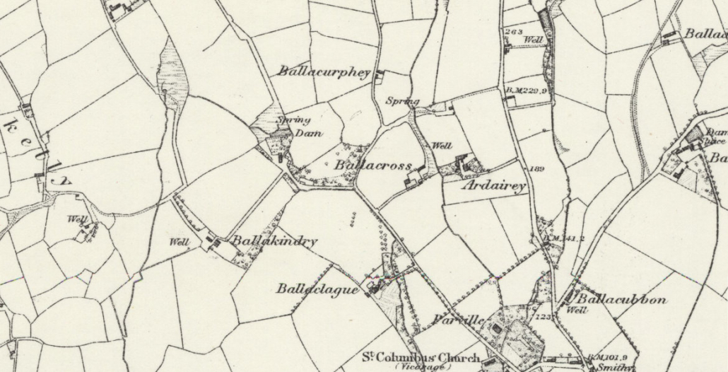
Grid reference: Location unknown. There is a well near the farm on the OS map but it is not known if this is the location of the holy well.
What3Words: Location unknown.
Access
Location unknown.
Links
NLS OS 6″ Sheet XVI Surveyed: 1868 Published: 1870
Contact
If you have any information on this well please contact me and quote well record number (7) as this will help identify which well you are referring too.
 Isle of Man Wells welcomes the opportunity to visit as many wells and springs as possible, particularly on private land and with the owner’s permission. If you would like to issue an invitation for us to visit a well or spring on your property please